Industries
Construction & Civil Drone Services
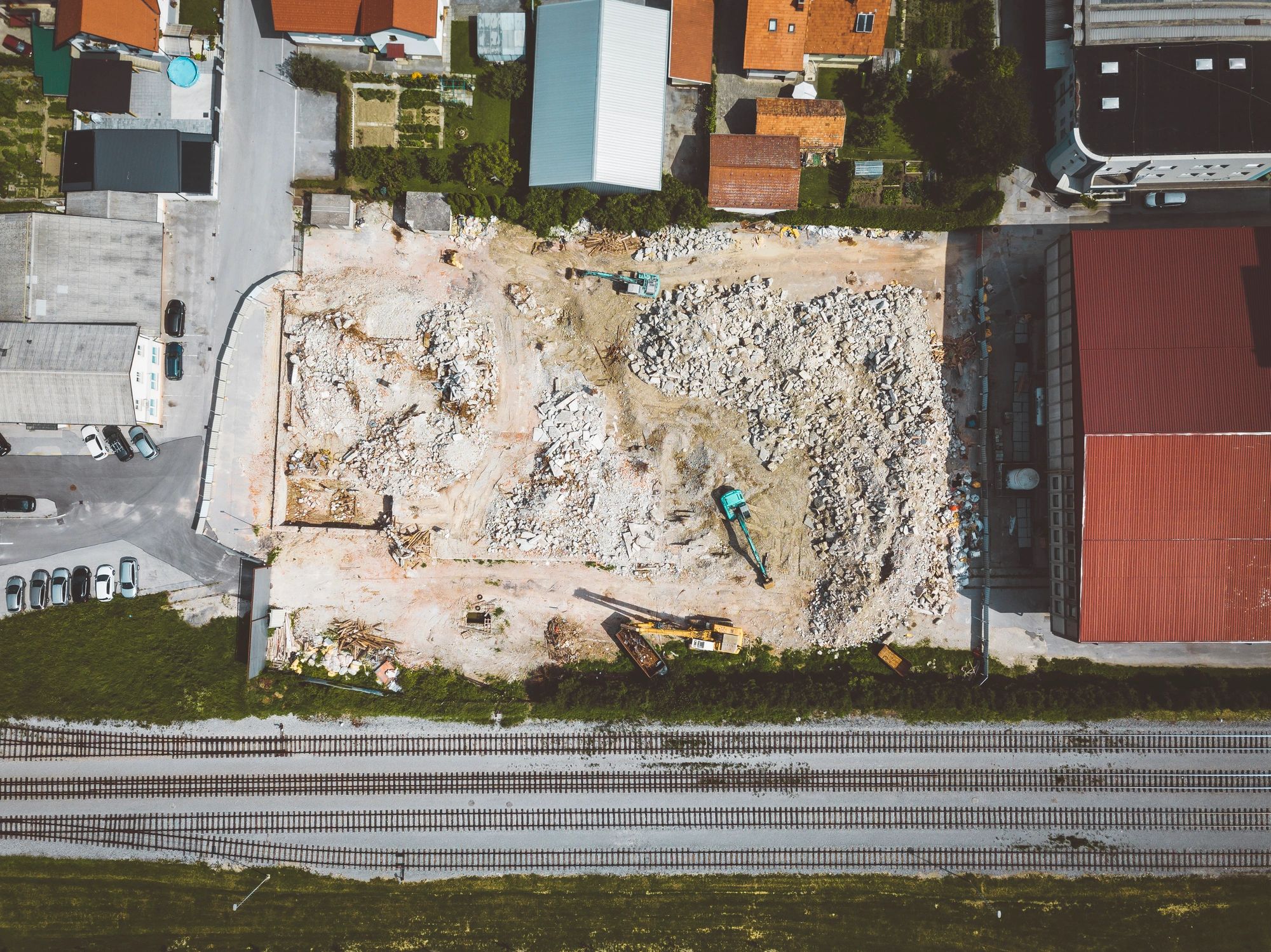
Hermes Drone Solutions LLC supports civil contractors, engineers, and project owners with accurate 2D/3D mapping, progress documentation, and volumetric measurements—delivered fast and formatted for your workflow.
Capabilities
What We Deliver for Civil and Construction Projects
From pre-construction planning through closeout, we provide clear visuals and measurable data products to support decision-making.
2D Orthomosaics & Site Maps
High-resolution, georeferenced imagery for planning, coordination, and documentation across the full site footprint.
3D Models, Point Clouds & Surfaces
Photogrammetry-based 3D deliverables to support earthwork analysis, design verification, and as-built records.
Progress Monitoring & Reporting
Recurring captures (weekly, biweekly, monthly or milestone-based) with consistent viewpoints for stakeholder updates and claims support.
Stockpile & Earthwork Volumes
Volumetric measurements for aggregates, spoils, and materials—supporting quantity tracking and operational planning.
Process
A Streamlined Workflow That Fits Your Schedule
We coordinate around site operations and deliver files in formats your team can use immediately.
1) Scope & Site Coordination
Define deliverables, accuracy needs, site access, and safety requirements. We confirm airspace considerations and flight windows.
2) Data Capture
On-site flights using repeatable flight plans for consistent results. Optional ground control/check points based on accuracy requirements.
3) Processing & QA
Photogrammetry processing, quality checks, and alignment to project control (as applicable) before delivery.
4) Delivery & Handoff
Deliverables provided via secure download with clear file naming and documentation for your CAD/GIS team.
Construction & Civil FAQs
Common questions from contractors, engineers, and owners.
What deliverables can you provide?
Typical deliverables include orthomosaics, point clouds, 3D meshes, contours/surfaces, and volumetric reports. We tailor outputs to your software and accuracy requirements.
How often can you fly for progress monitoring?
We support weekly, biweekly, monthly and milestone-based schedules. Repeatable flight plans help maintain consistent comparisons over time.
Can you support stockpile measurements for pay applications?
Yes. We can measure stockpiles and provide volume summaries that support quantity tracking and reporting.
Do you work around active site operations?
Yes. We coordinate with site leadership to select safe flight windows and maintain minimal disruption to crews and equipment.
Where do you operate?
We serve Oklahoma and surrounding states and can travel within the USA as needed for projects.
How do we request a quote?
Use the contact form to share the site location, timeline, and deliverables needed. We will respond with a clear scope and pricing.