Industries
Oil & Natural Gas drone mapping and inspection support
Hermes Drone Solutions LLC provides rapid, repeatable aerial data capture for upstream and midstream operations—supporting site planning, progress documentation, and asset awareness with clear visuals and mapping deliverables.
Operational value
Better visibility for critical energy assets
Use cases
Common oil & gas deliverables
Deliverables are tailored to your workflow—whether you need a rapid visual record or mapping outputs for planning and reporting.
Drill site and pad monitoring
Recurring aerial captures to document progress, logistics, and site conditions with time-stamped visuals.
Pipeline and ROW documentation
Aerial imagery and mapping to support right-of-way documentation, route context, and change tracking.
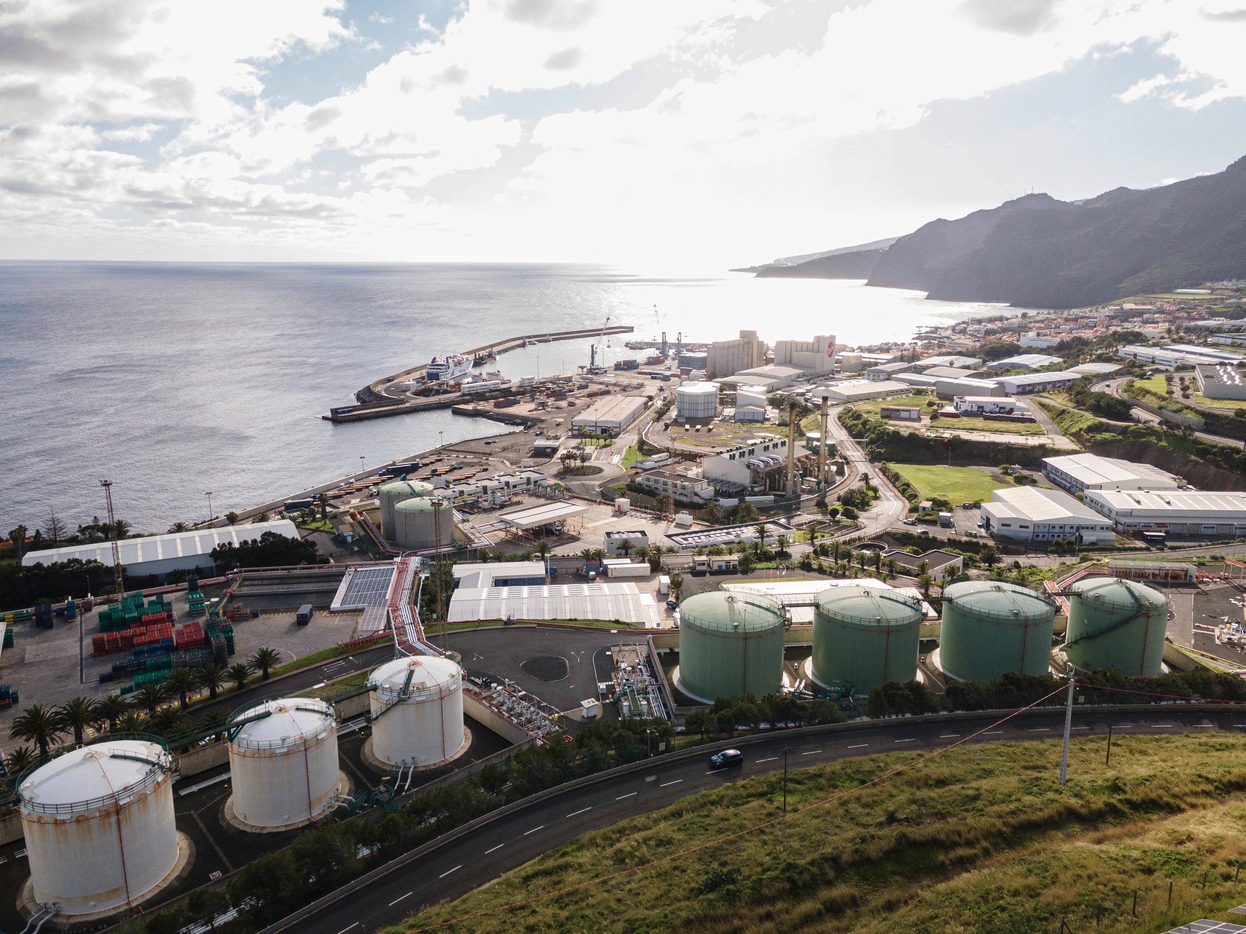
Facility and tank farm visuals
High-resolution imagery for asset awareness, maintenance planning support, and stakeholder communication.
2D/3D mapping for planning
Orthomosaics and 3D models to support site planning, measurements, and documentation needs.
Related services
Services frequently used in energy projects
Combine mapping, inspection, and monitoring to match the pace and complexity of oil & natural gas operations.